• Skip to primary navigation
  • Skip to main content
  • Skip to footer
  • Flood Recovery Loan
  • Contact
  • Facebook
  • Instagram
  • Twitter
  • TikTok
mountain association logo

Mountain Association

Building a New Economy, Together.

    • Access expertise to grow your business or organization.

      Business Support

    • Start Here
      • Learn About Support
      • Apply to Work with a Consultant
      • Success Stories
    • Resources
      • FAQs
      • Tools & Templates
      • SPARK Nonprofit Collaborative
      • Client Login
    • Expand your impact with our flexible loans.

      Talk to Us About a Loan

    • Start Here
      • Learn About Loans
      • Start the Application Process
      • Success Stories
    • Resources
      • FAQs
      • Flood Recovery Loans
      • CrowdMatch Loans
    • We can help you save money.

      Apply for an Energy Assessment

    • Start Here
      • Learn About Our Energy Program
      • Apply for a Free Energy Savings Assessment
      • Success Stories
    • Resources
      • FAQs
      • Solar Financing & Support
      • Energy Savings Microloan
    • Start something in your community.

      Learn About Training

    • Start Here
      • Training & Ideas
      • 479 Main Street Project
      • Success stories
    • Training
      • Airbnb
      • Business Training
      • Creative Economy Training
    • We can help tell your story.

      Read Our Stories

    • Stories
      • All Stories
      • Business Support
      • Energy
      • Lending
      • Training & Ideas
    • Appalachia’s New Day
      • Press & Media
      • Communications & Policy
    • Building a new economy, together.

      (859) 986-2373

      info@mtassociation.org

      Sign Me Up for News

    • The Big Picture
      • What We Do
      • Just Transition
        • How It’s Working
    • Our Story
      • Our History
      • Team
      • Board of Directors
      • Careers
    • Impact
      • By the Numbers
      • Publications
  • (859) 986-2373

    info@mtassociation.org


    Building a new economy, together.
You are here: Home / Training & Ideas / The Warrior’s Path Project: Restoring An Ancient Trail Throughout Eastern Kentucky

Training & Ideas

The Warrior’s Path Project: Restoring An Ancient Trail Throughout Eastern Kentucky

November 19, 2021

Share:

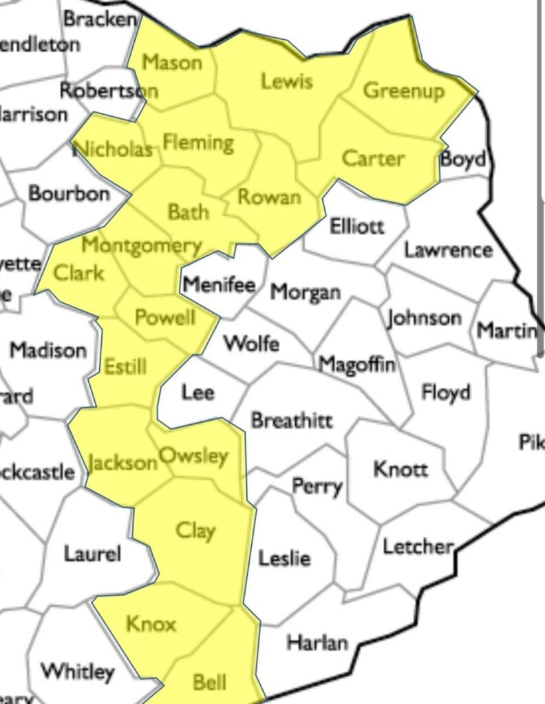
A group of Kentuckians is working to restore a 12,000 year-old trail that runs through about 20 Eastern Kentuckian counties, stretching 300 miles from Portsmouth, Ohio to the Cumberland Gap. Athawominee, or the Warrior’s Path, was established by Native American warriors who used it primarily as a route of commerce to trade natural resources such as sea shells, precious metal and flint, as well as for communication. The trail extends beyond Kentucky, running all the way from the Great Lakes to Gulf of Mexico.

warriors path Eastern kentucky native american indian 1
One of their first focuses was to develop a historical model based on a compilation of maps. They put it onto an aerial overlay and verified where known points are. Not only does the trail have Native American origins, but parts were used through civil war to bring slaves to freedom.

“A great tide of humanity used this trail, primarily on moccasin or hoof,” Max Hammond of the Warrior’s Path Project said. “The first and foremost goal of our efforts to honor and celebrate the history of the first Appalachians. Our next hope is that the trail will tie together mountain towns and bring more opportunities for economic development.”

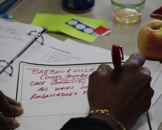
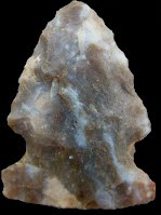
Hammond and other dedicated organizers have been working for about three years to learn about and bring awareness to the trail. The trail itself is nonlinear with many branches, forks, and saddles that follow ridgebacks from watershed to watershed. There are several historic sites and markers along the trail, such as petroglyphs, as well as turkey tracks, which are directional arrows that point travelers in the right direction.

Their plan for the next few years is to focus on developing or enhancing loop trails alongside the Warrior’s Path, and adding historical markers to indicate the path is nearby. For example, a trail user can park in a small town like McKee and enjoy a few miles of hiking, biking or horseback riding, and learn about the trail via informational markers. They hope to develop a Northern field office in Olive Hill (with the park at Tygart Creek eventually becoming the gateway to the Path), and a Southern field office in McKee.

warriors path kentucky native american trail

“The trail will be a journey through time, telling the compelling stories and illustrating the area’s history,” Judy Schmitt, co-chair of the Warrior’s Path Project. “The trail will be engaging, fun, and informative, connecting historical sites together and preserving the path. And it will encourage visitors to explore and experience places throughout East Kentucky, opening up our recreational opportunities and bringing new customers to our tourism businesses.”

“Every community has something unique about it, some treasure to bring people to the area and bring people to the great outdoors,” Hammond said.

The group has the support of the National Park Service, along with Kentucky’s Native American Heritage Commission.

“American Indian stories are too part of the history of this commonwealth,” Helen Danser, a representative of the Commission assisting with the project, said. “I’m extraordinarily pleased that the Indian voice is being heard.”

cumberland gap warrios path kentucky trail

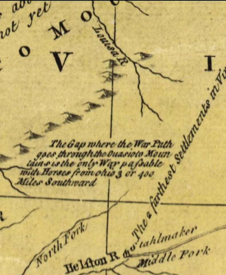
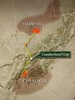
Danser said the trail is just one project of many efforts to make more space in Kentucky for indigenous communities. The organizers believe it is time that Eastern Kentucky has a place that truly honors the Native Americans, pointing out that Jenny Wiley State Park in Prestonsburg is named after a white woman who fled from Native Americans, and Sheltowee Trace trail that extends through Eastern Kentucky celebrates Daniel Boone, a white settler. White settlers like Boone came into Kentucky through the Cumberland Gap in the 1700s, the only navigable way to come into the state. By opening the gap, these settlers drove Indians out of their territory.

“We are all working towards not reconciliation, but collaboration and understanding,” Danser said.

The organizers hold monthly meetings via Zoom to make progress on the many aspects of the project. Right now, they are working to establish 501c3 and looking for state and federal funding to support their efforts. They are also actively looking for local people who have knowledge of the trail to compile a more complete history of the trail. They plan to partner with Eastern Kentucky University students to organize the archives that are developing.

chert carter caves
The abundance of Chert, a type of flint, made the caves of Carter County a valuable place for early Native Americans and tradespeople. This history makes Olive Hill a natural place for one of the trail’s gateways.

In the future, the group hopes to partner with the Mountain Association to enhance their website. For now, you can follow the Warrior’s Path National Historic and Heritage Trail of Kentucky project via Facebook: https://www.facebook.com/Kentuckyjourney

“This is a multi-generational project,” Danser said. “We will all have to put our time, money and physical investment into the trail.”

Author

Ariel Fugate

Communications Coordinator

ariel@mtassociation.org

Recent Posts

moutain grrl pikeville)ky

Community Development

Mountain Grrl Experience: More than a Music Festival

Imagine you are roaming the streets of Pikeville, Kentucky one summer day and you’re handed a set of spoons to make music with. You knock out a number ... Read This Post

Kidfolk sensory prestonsburg ky eastern

Business Support

Eastern KY Moms Help Their Communities Become More Accessible

“There are days I would move a mountain to make sure my kids got everything they needed,” Courtney Crider said over the phone as she makes the long ... Read This Post

Energy

What to do if you got a bad install by Solar Titan

File a Complaint Against Solar Titan Many Kentuckians are reporting bad solar installations completed by the now defunct Solar Titan. There may be ... Read This Post

Footer

mountain association logo

For more than 40 years, we were known as the Mountain Association for Community Economic Development (MACED).

As we enter a new decade and a new look, we have become the Mountain Association. This change underscores our commitment to a new beginning that is more inclusive and welcoming to the people and communities we serve.

Donate Now 1

Get the Newsletter

Sign Up Now

  • Programs
    • Business Support
    • Lending
    • Energy
    • Stories
    • Training & Ideas
  • About
    • What We Do
    • Just Transition
    • Team
    • Our History
    • By the Numbers
  • More
    • Donate
    • Careers
    • Board of Directors
    • Publications
    • Sponsorships

BEREA
(859) 986-2373
433 Chestnut Street
Berea, KY 40403

Meetings by appointment only

info@mtassociation.org

We are happy to make any
accommodation to better serve you.
Inquire via phone or email.
If hearing or speech impaired,
please dial 7-1-1 for relay
services prior to calling.


HAZARD
(606) 439-0170
420 Main St
Hazard, KY 41701

PRESTONSBURG
(606) 264-5910
268 E Friend St, Ste 101
Prestonsburg, KY 41653

Copyright © 2023 Mountain Association | Privacy Policy | Terms & Conditions | Non-profit Disclosures

made by P&P